 Vernal Falls
It started innocently enough; a woman named Lisa bringing up a moonlight hike to Half Dome ... me thinking, that's a great idea.
I floated the idea out on Facebook, and my youthful friends quickly chimed in with versions of "I'm in." Some friends were skeptical, others feared we may die like
this guy. We talked it over several times, gradually we became advocates for the trip. July 7, after work, we leave for Yosemite, drive to the trail head before midnight, charge up the mountain with moonlight and arrive at dawn, rest a bit and hike down. We had a plan. The Gang of Four™, the Santa Clara Four, the Blues Brothers, half a pack a smokes, a tank of gas, and a mission ... We definately had a plan.
B and I had a 7 mile test hike a few days before; our cear checkes out and we both performed well. Robert had been on the May 17 hike and had done well, George, was pretty much an unknown. He was around 30 and worked all day on his feet ... so I figured he'd manage.
From the trailhead parking lot near Happy Isles to the top of Half Dome and back is roughly 17 miles by my estimate. It climbs around 4500 feet vertically from a starting elevation of about 4000 ft. The trail is mostly hard rock staircases and sandy, rocky trail. It's a substantial hike by most standards. Colder temps during the night and the longer duration of the hike would mean carrying a change of clothes, some real food, and around 3 liters of water. We carried a first aid kit, a water filter and navigation stuff, we we shared the weight of between us.
Although this is a perfect application for my trail runners, they had broken down considerably, so I wore my ever faithful boots.
The 7th arrived, and at the alloted time of 6 PM, we still weren't on the road. Because of the sad state of all of our cars, we rented a car. So we started out at 8 or so. Since some of us hadn't eaten we stopped at the Nations in Hayward for some burgers and fries. We arrived after 1 AM. at 2:00 we were dressed, packed and in the restroom at the trailhead laughing it up, excited to be on the trail.
 Robert, Bassel and George in the Restroom at the Trailhead.
 The first few minutes of the hike were odd and interesting. As we packed, a ranger cruised through the parking lot, checking us out. We had this strange picture taking session in the restroom at the trailhead, just before we left. We stepped out onto the road, which turned into paved trail ... I led an agressive pace into the first section of the hike. the mile or so up the bridge below Vernal Falls.
We rested and watched as George hurled his Nation burger into the Merced River off the edge of the bridge. I should not write about this, but I'm going to. It happens to the best of us. From that point we left the paved trail and started the 600+ step climb to the top of Vernal Falls. Although we believed we might be able to do this solely by the moonlight, we really needed our headlamps to navigate. It's a fairly broad trail, and at night, there's no traffic to speak of. I tried to take pictures, but my Canon 20D is limited in it's after dark capabilities by it's 30 second exposure maximum (stupid engineers). We continued up the trail with relative ease ... the first real challenge being the last section before the crest of the falls. Fortunate the darkness hid any danger of falling ... and we managed to make it to the top of the falls without even the slightest difficulty.
The next section is a bit challenging. finding and staying on the trail, and locating the bridge is a bit interesting in the dark. We met a family of hikers that misdirected us up the Muir Trail ... and told us it was the Mist Trail. We knew better and eventually found our way.
The next stretch of the trail went about the same, but the delay finding the bridge and the short misdirection up the wrong trail all teamed up to slow us down. We climbed the trail up beside Nevada Falls and arrived at the trail junction above the falls at first light.
We ate, took a break, took crappy pictures, rested. I adjusted my boots. We had travelled about 4.2 miles.
 Bassel and George Recovering at the Top of Nevada Falls
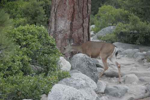 We Saw a Deer
  Is that Half Dome?
We hiked through Little Yosemite Valley along the Merced River to the campground ... we didn't stop.
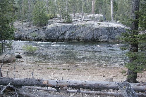 Merced River in Little Yosemite Valley
We hiked through to the trail to Half Dome. Through the sandy trails of Little Yosemite Valley to the trail head for Half Dome. 4 miles to go. We forged ahead.
 Fire
Fire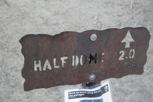 ... Bear Danger
 We began to climb again in earnest. The next 4 miles covers about 2400 vertical feet, winding around the back side the mountain. We just kept moving up the trail. as we near the top it is about 10 AM. It is stunning.

People climbing up the cables to the Half Dome summit.

My friends near the top.
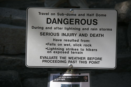 Danger
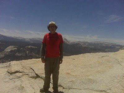 Me at the top of the "Sub-Dome."
View of the cables and Half Dome Summit from the sub-dome. The Cables -- Photo Robert Hendrickson
  View of the Diving Board -- Photo Robert Hendrickson
 George Makes it to the Summit -- Photo Robert Hendrickson
 Robert Summits
Bassel wanted to turn back somewhere below the top of the sub-dome, so he and I went back down to the flat just below that, while George and Robert continued to the summit. Although I started back up to fetch the boys when it was time to go, I didn't actually make it to the summit, because they were on their way down already.
At about 11, we headed down, beginning the hammering downhill that would eventually damage my foot fairly severely. Amid pressuires of running out of water and getting off the mountain before my left foot disabled me in earnest, we headed down the stony path.
 Nevada Fall
 Bassel Leading the Way Below Nevada Falls
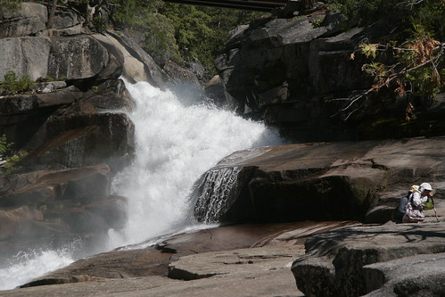 The Silver Apron
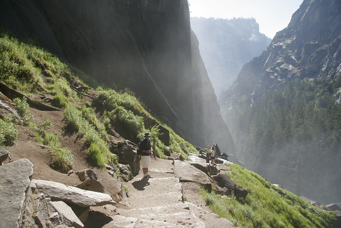 Mist Trail
  Danger, Rattlesnake
See the entire set of photos
here.
UPDATE: About a month after this, x-rays revealed that I had fracture the second metatarsel in my left foot -- in the way commonly referred to as a march fracture. It's a stress fracture, and is healing well -- albeit slowly.
.JPG)
.JPG)
.JPG)
.JPG)
.JPG)
.JPG)
.JPG)
.JPG)


 kielty
