Showing posts with label happy hiking guy. Show all posts

Saturday, June 27, 2009

East of Phoenix


"See you on the other side," I say.

"The other side of what," is the usual response.

The void, the abyss, that place where everything is meaningful, where it's all meaningless; the wilderness.

I know, I know. Isn't that being just a bit melodramatic. Of course, but just a bit. I am in a campground in East Mesa, gwarfing a soda and typing this dribble into my Blackberry. There's a starbucks just a few blocks away. Showers and flush toikets. Not much like the wilderness. Nevertheless, entering a place like the Sonoran desert is a bit risky. Even as an idle camper, a fall can be catastrophic. Disorientation can lead to disaster. Bad planning can be fatal.

Traveling in the wilderness offers certain hazards. In the Sonoran desert the hazards are severe. In the Superstition wilderness they are at thier most extreme. There are no berries to pick, no rivers to bathe in, water is rare, hard to find and unreliable. The landscape is course and steep, the trails confusing and rarely travelled.

When I enter the Superstitions I do it with the grave seriousness and respect they deserve. At every opportunity this wilderness picks and tears at the human body, scratching, cutting, burning ... It's hardball.

To be in a place of such glorious beauty, such austerity, difficulty ... well it's sublime; profoundly good. To be back on this side, reasonably intact, is also good. To see an end to the thorns, the 105 degree temps, the humidity. To rest, to prepare to do it again, to have bragging rights or a good story to tell, is all good stuff.

I spent two days in the Superstition wilderness last weekend. The Happy Hiking Guy and I hiked from the Peralta trailhead to Le Barge Spring in a big ugly loop. It was largely uneventful, just two guys in the desert sun, a shitload of wilderness, and 16 miles of pain.


Tuesday, November 20, 2007

It's About the Weather ...

When you have it this good, it's hard to complain. Rumour has it that it will cool down on Friday -- to 70. Drag. Another rumour is that there is a bike ride scheduled this afternoon with the happy hiking guy.

Anyway, I went out for a short hike from the campground this morning. Turned into about 6 miles including the Blevins loop and the Wind Cave trails. Very cool.


Morning sun moonscape.


This bee hive at the top of the wind cave trail.

And all these (22) people going up to look at them.

Blevins trail with the Superstitions in the distance.

Wednesday, May 9, 2007

The Coefficient of Juju


So it started, a small idea for a little trip. A short pack trip. One night with a modest hike near Phoenix. Here we three are at the start, at the Reavis Ranch trail head. 3.5 miles up and a steep uphill -- to find this view --

and then we descend into Shawn's Garden, proclaimed to be so by me, because of it reminding me of Garden Valley. It was confirmed immediately by the Happy Hiking Guy™, and Dale was there to witness it, so now it is true, and I think the USGS is going to add the place name to the maps. You'll see another picture of it later, because, frankly, I liked it.


These are Beavertail Cactus of some sort or another. They are spiny and I think I still have some spines sticking out from my neck from when I smacked one with my face.

The descent into Reavis Creek was steep and despite a lot of preparation my right knee was threatening to disable me slow me down. Add vitamin I.

We saw this Horny Toad (Phrynosoma platyrhinos calidiarum, technically a Horned Lizard), which was cool. The horned toad has a very high coefficient of juju. One might ask, what is the coefficient of juju? This was actually Dale's terminology. I was talking about juju, as it relates to desert critters, like coyotes or lizards. I always thought juju was sort of like luck plus savvy. A lizard can run across hot desert sand and hide through camouflage, and then just when you've managed to get ahold of his tail, he breaks it off, combining surprise with speed to escape to safety. That's some large coefficient of juju. Man makes water from a desert mud hole and gets a desert survival badge. I was a bit worried the pain in my knee would lower my juju.


This is the Sierra Designs Light Year single and my home for the night. My playmates went off to find Reavis Falls while I looked around for an ice pack for my knee, made water and ate.

My legs were seriously cooked and my feet (dogs in the vernacular of Dale) were throbbing, which proved a bit difficult in the somewhat limited space of the SD Light Year.

The trip out went well.

This is the overview of Shawn's Garden. It is difficult to do this any justice with a camera. It might be the biggest collection of Beavertail cactus in one place in the world, who knows. Enlarge this photo and look at how many thousands of pads there are. Although I wasn't lame at all on the trip out, as you can see in this picture, Dale has my food bag hanging from his backpack, and I am following him like Pavlov's dog. Despite being 4 miles from the car, I am seriously ready for a bowl of screaming hot chili at Tortilla Flat. I stopped for lunch about 45 minutes later.

Me with Apache Lake in the background.

There's the car and two bowls of that chili.

Sunday, August 6, 2006

Superstition Wilderness -- Bluff Spring Loop


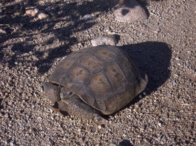
Desert Tortoise in Miner's Canyon, Superstition Wilderness.

Well -- there's so much to talk about today. This is the hike that started my romance with the Superstition Wilderness. A little over a year ago one of my friends introduced me to the happy hiking guy, because we both were going out to hike on a regular basis in the heat of the Summer.


Near the Dutchman's trail right near the start of the hike.

On one day in July of last year we took a hike together for the first time. The 10.5 miles (despite the map saying it's 8.5, my gps said it was 10.5 last time I went) of the Bluff Spring Loop. We started out at 6:00 AM, just like today, and when we finished at 11:30, it was a respectable 109°F. Today was more like 100°F and we finished at 11:00 or so.

During today's hike we talked about how much my health had improved over the last year. It was clearly obvious during the hike because we could compare it to last year. I really thught I may die (from the heat, or just from exhaustion) on the hike last year, this year I was strong and comfortable for most of the hike.

Since Dale, our mutual friend, also joined us, we could make comparisons to the ill-fated Superstition Ridgeline hike of November last year, which the three of us did together as well. The Superstition Ridgeline hike is 11 or so miles, with about two miles of verticle element. The Superstition Ridgeline hike ended some 12-13 hours later with me barely able to walk. Today's hike contained none of the pain I have had on almost every hike I have taken since then.


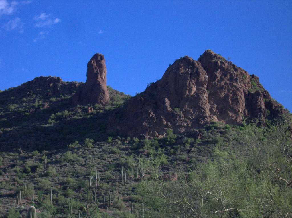
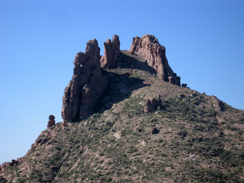
Miner's needle from the "front." Superstition Wilderness.


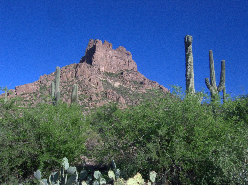
Miner's needle from the "back." Superstition Wilderness.

There is some descepancy in the naming of the trails. The USGS Topo map of the Weaver's Needle Quad dated 1966 clearly calls the route to the right out of the Peralta trailhead Miner's Trail. New maps and the signs on the trail call this the Dutchman's Trail (104), so that's what I am going to call it. To complicate things more, the USGS map calls the Bluff Spring trail the Dutchman's trail. Ever wonder why people keep getting lost? So for the section of the trail from Bluff Spring to Peralta (completing the loop) I am going to use the current name of Bluff Spring trail.


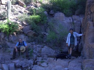
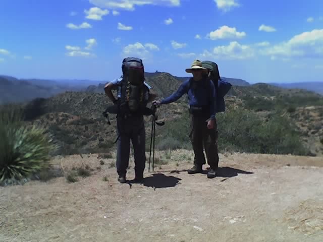
Dale and I in Miner's Canyon.

The hike started uneventfully with the three of us heading out with out much thought, and we traveled the easy 2.6 miles out to the junction with the trail to Coffee Flat, crossing a couple of small streams on the way. Then we made the ascent to Miner's Summit, a saddle next to Miner's Needle where you can find the junction of the Dutchman's trail and the Whiskey Springs trail.


Chris at the Whiskey Springs Trailhead.

From the Miner's Summit the trail heads down into Bluff Spring Canyon to Crystal Spring, and the junction with the Bluff Spring trail, which leads back to the Peralta trailhead. It crosses Barks Canyon before descending into Peralta and the trailhead. Today there was water in most of the canyons along the trail; I was surprised.


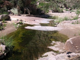
There was Running Water in Bluff Spring Canyon, Superstition Wilderness.

There was all this water and everything was green. Despite the heat and humidity, I think the monsoon season is my favorite time of the year to be in this desert. The descent into Barks Canyon is steep and the color was awesome.


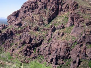
The Steep Wall of Barks Canyon in the Superstition Wilderness.

Today's hike is probably the last hike in the Superstitions before I leave for California. It was a great closure to a long sojourn to Arizona. Who would think it possible to see a Desert Tortoise and a Gila Monster in the same day and not be at the zoo. It will take more than a few tears to say goodbye.


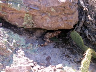
Amid Speculation that this is a Mexican Beaded Lizard, I am going with this ID, a Banded Gila Monster, (Heloderma suspectum cinctum) in Bluff Spring Canyon, Superstition Wilderness.