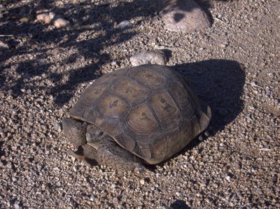
Desert Tortoise in Miner's Canyon, Superstition Wilderness.
Well -- there's so much to talk about today. This is the hike that started my romance with the Superstition Wilderness. A little over a year ago one of my friends introduced me to the happy hiking guy, because we both were going out to hike on a regular basis in the heat of the Summer.

Near the Dutchman's trail right near the start of the hike.
On one day in July of last year we took a hike together for the first time. The 10.5 miles (despite the map saying it's 8.5, my gps said it was 10.5 last time I went) of the Bluff Spring Loop. We started out at 6:00 AM, just like today, and when we finished at 11:30, it was a respectable 109°F. Today was more like 100°F and we finished at 11:00 or so.
During today's hike we talked about how much my health had improved over the last year. It was clearly obvious during the hike because we could compare it to last year. I really thught I may die (from the heat, or just from exhaustion) on the hike last year, this year I was strong and comfortable for most of the hike.
Since Dale, our mutual friend, also joined us, we could make comparisons to the ill-fated Superstition Ridgeline hike of November last year, which the three of us did together as well. The Superstition Ridgeline hike is 11 or so miles, with about two miles of verticle element. The Superstition Ridgeline hike ended some 12-13 hours later with me barely able to walk. Today's hike contained none of the pain I have had on almost every hike I have taken since then.
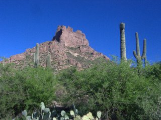
Miner's needle from the "front." Superstition Wilderness.

Miner's needle from the "back." Superstition Wilderness.
There is some descepancy in the naming of the trails. The USGS Topo map of the Weaver's Needle Quad dated 1966 clearly calls the route to the right out of the Peralta trailhead Miner's Trail. New maps and the signs on the trail call this the Dutchman's Trail (104), so that's what I am going to call it. To complicate things more, the USGS map calls the Bluff Spring trail the Dutchman's trail. Ever wonder why people keep getting lost? So for the section of the trail from Bluff Spring to Peralta (completing the loop) I am going to use the current name of Bluff Spring trail.
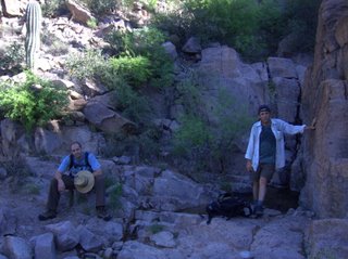
Dale and I in Miner's Canyon.
The hike started uneventfully with the three of us heading out with out much thought, and we traveled the easy 2.6 miles out to the junction with the trail to Coffee Flat, crossing a couple of small streams on the way. Then we made the ascent to Miner's Summit, a saddle next to Miner's Needle where you can find the junction of the Dutchman's trail and the Whiskey Springs trail.

Chris at the Whiskey Springs Trailhead.
From the Miner's Summit the trail heads down into Bluff Spring Canyon to Crystal Spring, and the junction with the Bluff Spring trail, which leads back to the Peralta trailhead. It crosses Barks Canyon before descending into Peralta and the trailhead. Today there was water in most of the canyons along the trail; I was surprised.
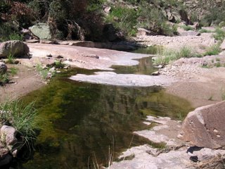
There was Running Water in Bluff Spring Canyon, Superstition Wilderness.
There was all this water and everything was green. Despite the heat and humidity, I think the monsoon season is my favorite time of the year to be in this desert. The descent into Barks Canyon is steep and the color was awesome.
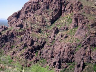
The Steep Wall of Barks Canyon in the Superstition Wilderness.
Today's hike is probably the last hike in the Superstitions before I leave for California. It was a great closure to a long sojourn to Arizona. Who would think it possible to see a Desert Tortoise and a Gila Monster in the same day and not be at the zoo. It will take more than a few tears to say goodbye.
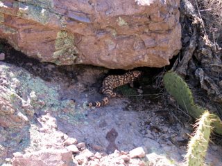
Amid Speculation that this is a Mexican Beaded Lizard, I am going with this ID, a Banded Gila Monster, (Heloderma suspectum cinctum) in Bluff Spring Canyon, Superstition Wilderness.