Showing posts with label wilderness. Show all posts

Tuesday, July 17, 2007

Lessons in Grace ...


In The Charcoal Cathedral

4 days in the charred remains of an ancient wilderness. 26 miles on foot. 2 Black Bears, one Bald Eagle, 3 Mule Deer, a Western Tanager, the sound of an Owl. One river, three springs, two dogs, two friends. I think I might have heard the sound of a Woodpecker. 4 days in the charred remains of an ancient wilderness.

Humility sanctified. Lessons in grace.

There was hope. The trip was defined simply enough. Hike from Chinaman Hat to the Illinois River at Collier Bar via the 1161 (or 2) and 1174 trails in the Kalmiopsis wilderness. By way of Bald Mountain Spring, Polar Spring, and the spring at the Pup's Camp. Around 13 miles each way.

The trail was rough and hard at the beginning and end, with a 3000 ft. descent from Bald Mountain into the Illinois River canyon representing the most formidible feature. It was a difficult and challenging hike. The first day we hiked to Bald Mountain Spring and then to Polar Spring and broke off to make camp at the Pup's Camp, totalling 9 miles or so for the day. The climb from our parking spot to Bald Mountain spring barely served to warm us (my friend Jim and I, the dogs Josie and Lily) up, and as the day progressed it seemed clear that our pace was not going to bring us to the IllinoisRiver by the end of the day. We shot photos and videos and looked for cougar (0), or as the local teen trail cleaner girls called them, "Screamers," which was followed with a bit of giggling. And bears (2), or Elk (0) or Deer (3). We lally-gagged at the springs, drinking deeply, and growing used to the wilderness. Jet fighters flew through a cloudy sky to help minimize the culture shock.

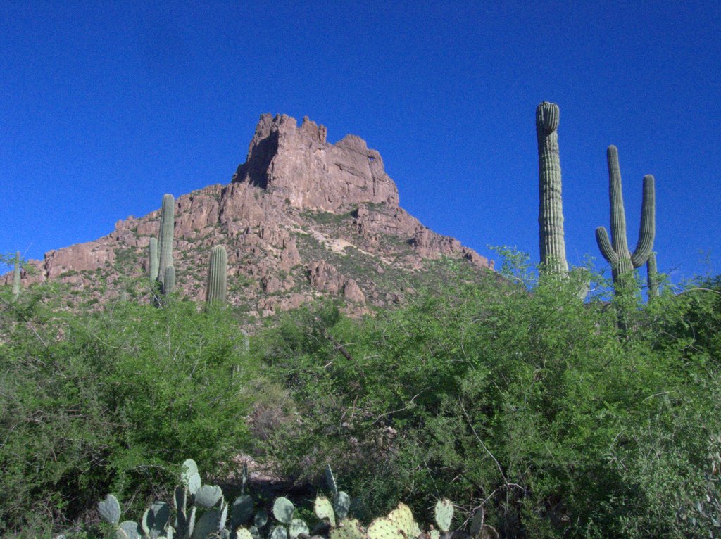
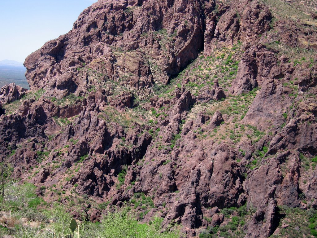
We fought our way down the trail. There was a lot of debris, since the forest was burned to a crisp in the 2002 Biscuit fire. Some areas were also burned in the 1987 Silver Complex Fire. There were many fallen trees and branches blocking the trail. Sometimes it is so much easier to walk around and step over the obstacles. It appeared the no one had been down the trail since last summer. We were alone. There was very little life and no bird song. It was ominous and severely quiet.

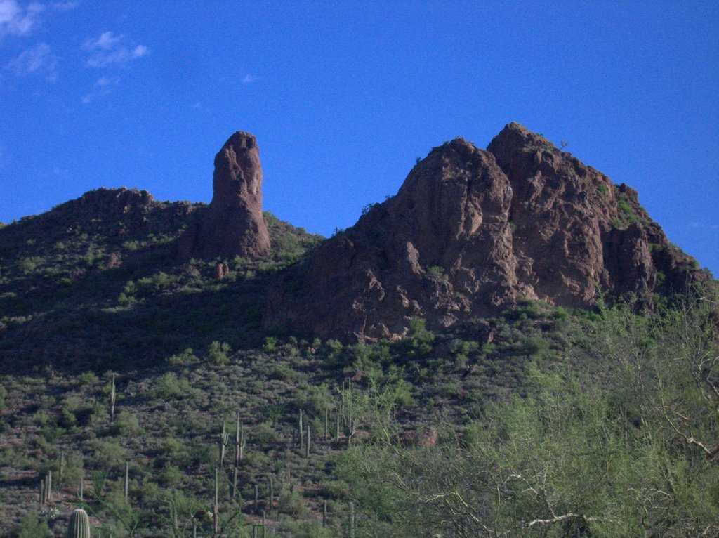
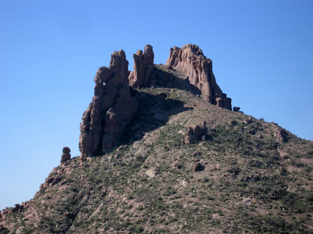
Charred giants. Entire hilltops rendered treeless. Sticks remaining. Large sticks. A forest destroyed, charred beyond comprehension. I was there in 2003 or 2004, and although the carnage was obvious, I just saw the edge of it. The Biscuit fire was the largest fire in Oregon's history. That forest was torched, totalled.

It is still inherently beautiful.

There is no way to describe in words or pictures the awesome power whose force is evident before me. And how insanely gorgeous I found this forest to be.

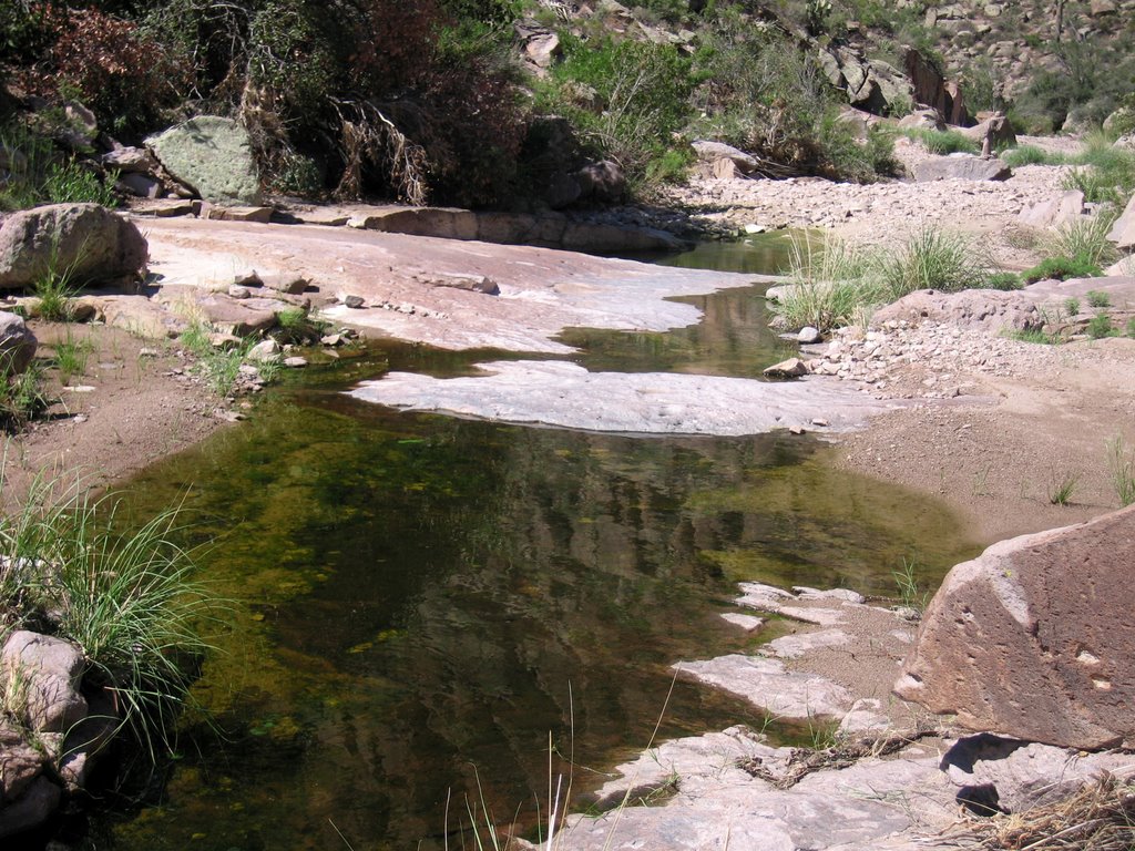
Part of the reason for stopping at the Pup's Camp was my concern about my knee and going downhill. We spent the night there and in the morning we hiked the 4 miles and 2000 ft down into the steep Illinois River Canyon and set up camp. This was a bit hard on my knee. But not as bad as the poison oak. I have poison oak. I got it 3 or four different times on this trip. The trail was overgrown with Poison Oak. The Elder Brother says that "it used to be called the poison oak forest ... ." Jim insisted that I eat tablespoons of Certa™ and I put Gold Bond™ cream on it. It disappeared. Like a badge of honor that vanished. I swam and bathed in the Illinois River. We hardly moved from the camp at Collier Bar until Monday when we packed up and bailed out with a bit less than a days food left, to hike the 13 miles out. We did discover this hornet's nest hanging in a tree almost in camp.


Oh -- The mushroom girl might enjoy this.

Lily at the first bath in the Illinois River.


Jim the videographer.

Josephine in the river cooling down.

The hillside across the Illinois River from our camp.
Jim on the QRP (low power) radio checking in from Collier Bar.
Remember these.

And there was hope everywhere.

On the way back down the trail we met a party of 12 of Oregon's youth clearing the trail. Their leader told us that while we were out the fire level had risen to 2, meaning no open campfires, and that they were to spend a week clearing the trail to Silver Creek. They were a sign of hope in a stale climate of preserving, rather than enjoying the wilderness. 12 young people learning early lessons of work and joy in the wilderness. So there is hope, we saw other signs of hope.

Like the Black Capped Rasberries and Hungarian Blackberries that compensated for the fact that we had run out of food. I think we may have eaten several pounds of rasberries each.

Those are rasberries there in the foreground. Despite the dead trees everywhere, the understory had sprung to life with layers of Madrone and Douglas fir, oaks, rasberries and poison oak. There was a carpet of a youthful forest before us, promising to return to a past glory. There were places with a hundred fir trees per meter. It was stunning; brilliant in both the vibrance and urgency of the new growth.
Coming down the last hill, I hammered my toe, and I will probably lose the toenail. My knee was fine during this descent, and I am hoping that the pounding I took over 4 days has finally convinced my body to behave.

There was hope everywhere. Hope for me, in my 4 day marathon in charcoal, and hope for the forest. The two represent personal bests for me. Longest trip at 25+ miles, and longest single day at 13 miles.

End of the trail.

Wednesday, June 27, 2007

"Hey, Where are You Going? ...


... the brown maps are over here. You always get the brown maps." My map order is here and the maps are green. Four maps. Onion Mountain to Chinaman Hat to Bald Mountain to Polar Spring to Collier Bar on the Illinois River. That's 4 green maps. Southern Oregon is green, and so are the maps. Gosh, I hope there's water.


I am packing now for a trip in the Kalmiopsis Wilderness. The plan is 4 days, and I am guessing about 30 miles. Fire season is here and I am concerned about using liquid fuel in a highly volatile forest. I may look into a propane stove for the summer months here in the west.


The top photo is Rainie Falls on the Rogue River, and the others are from a place we (the other Jane and I) stopped during a hike to Rainie Falls several years ago.

Sunday, April 22, 2007

Backpack Checklist

CLOTHES

___ 2 pair extra socks smartwool hiking & Wigwam Gobi liners 7.0 oz.
___ North Face convertible pants 1 lb.
___ SmartWool Microweight Long-Sleeve Crew 6.3 oz.
___ Patagonia Capilene 3 bottoms 5.1 oz.
___ Alpaca Hat 1.90 oz.
___ Outdoor Research Wool Pullover 14.1 oz.
___ North Face Summit Rain Parka 1 lb. 12.2 oz
___ marmot precip rain/wind pants w/stuff sack 7.80

Subtotal for Clothes: 4 lbs 11 oz

SHELTER & SLEEPING SYSTEM

___ Sierra Designs Light Year Tent 3 lbs. 15 oz
___ North Face Snowshoe sleeping bag, 3 lbs. 10 oz.
___ Therm-a-rest Pro-Lite 4 Regular 4-season ultralite mattress 1 lb 9.5 oz

Subtotal for Shelter & Sleeping System: 9 lbs. 1.5 oz.

PACKING

___ Kelty RedCloud 5600 6 lbs. 0.5 oz.
___ equinox pack rain cover 3.67
___ stuff sacks, freezer bags, & garbage sacks 4.00

Subtotal for Packing: 6 lbs. 7.72 oz.

COOKING & WATER

___ Katadyn Hiker Microfilter with stuff sack 14.8 oz.
___ 2 Nalgene 1-liter water bottles 12.50 oz.
___ 1 Platypus 2-3 liter hydration bag/pouch.
___ coffee pot w/lid, cup, fork, and spoon 1 lb.
___ mesh “kitchen” bag (includes condiments, toothbrush & powder)
___ MSR Whisperlite Stove 15.4 oz.
___ matches 0.35 oz
___ cigarette lighter
___ bear bag 3.49

Subtotal for Cooking (without food & fuel): 3 lbs. 0.72 oz.

NAVIGATION

___ monocular 2.1 oz
___ Silva Ranger compass 1 oz
___ maps (2 @ .2 oz per map) 0.5 oz
___ Waterproof notebook, pencil, reading specs 0.5 oz
___ Aurora Princeton led headlamp w/ 6 AAA batteries 4.2 oz.
___ (1)Streamlight Scorpion Stinger Flashlight 3.3 oz

Subtotal for Navigation: 11.60

ESSENTIALS & OTHER ITEMS

___ first aid kit 6.0
___ (*) waterproof matches
___ (*) firestarter ~
___ Gerber Folding Saw
___ (*) duct tape ~
___ (*) fox plastic whistle ~
___ all (*) items in small freezer bag 3.30
___ signal mirror
___ bug guard/sun block 3.00
___ sting-eze bug-bite/bee-sting relief 0.78
___ Dermatone Lip Balm with Lanyard 0.35
___ tent repair kit 0.5
___ expedition sewing kit 0.74
___ pack towel 1.52
___ toilet paper 1.50
___ candle

Subtotal for Essentials & Other: 17.69

PACK WEIGHT NOT INCLUDING FOOD, WATER & FUEL: 22 lbs. 6.63 oz

___ Fuel for 3 days (includes extra): 13.20 oz
___ Food for 3 days (23 oz per day x 3 "full" days): 4 lbs. 5oz.
___ 2L Water 4 lbs. 4 oz.

Total weight: 9 lbs. 7.83 oz.


TOTAL PACK WEIGHT: 31 lbs 7.25 oz

CAMERA

Canon 20d with 17-85 lens 3 lbs. 4 oz.

THE GEAR I WOULD BE WEARING

___ Gerber Freeman folding knife 7.8 oz.
___ Nordstrom Off white cotton oxford shirt 11 oz.
___ North Face Polargaurd vest 1 lb.
___ GPS with neck lanyard
___ REI Men's Sahara convertible pants 1 lb 3.4 oz
___ smartwool hiking socks & Wigwam Gobi liners 3.5 oz
___ Merrill Wilderness Boots 3 lbs. 10 oz.
___ Manfrotto 679B Monopod, to double as a hiking pole. 1 lb 4 oz.
___ Smith Factor Sunglasses 4 oz.

Wearing weight 148.97 oz or 9 lbs. 4.97 oz.

GEAR TOTALS

Pack 31 lbs 7.25 oz.
Camera 3 lbs. 4 oz.
Body 9 lbs. 4.97 oz.

Total Burden 44 lbs 0.22 oz.

Thursday, April 19, 2007

Back to the Desert

I am getting ready for a trip to the desert; a backpacking trip. The last real backpacking trip I made was in the spring when I was 20 or so to Cloud's Rest in Yosemite. I might even be as strong as I was then, although a lot less likely to make that hike.

This is a Banded Gila Monster, (Heloderma suspectum cinctum) in Bluff Springs Canyon, Superstition Wilderness. August 6th, 2006.

*******************

John awarded me this:

because I offered him a choice between beer and food, which he clearly decided was thought provoking. Then he immediately used up some choices for tagging granting this wonderful award. Folks like Jill and Joanne, good thinking bloggers, very deserving of such prizes. A nice guy. I am proud to be in such good company.

I have previously declared myself immune to tagging, but apparently unilateral decisions like that don't necessarily work. In my acceptance speech, I'll say something nice about him.

Five people who have made me think ... recently. Dillon, who leaves me fascinated that he can be so objective about such a polemic subject. Paul, for reminding me of Phoenix's darker side. BirdChick, when I was young the Whooping Cranes fascinated me. Lauren who has left me wondering about poop habits or poo, more than once ... And Marscat, whose story I can't wait to finish. Thinking Blogger Awards to each of you.

The rules:

1. If, and only if, you got tagged an award, write a post with links to 5 blogs that make you think.
2. Link to this post so that people can easily find the exact origin of the irritant award.
3. Optional: Proudly display the ‘Thinking Blogger Award’ with a link to the post that you wrote.

Sunday, August 6, 2006

Superstition Wilderness -- Bluff Spring Loop


Desert Tortoise in Miner's Canyon, Superstition Wilderness.

Well -- there's so much to talk about today. This is the hike that started my romance with the Superstition Wilderness. A little over a year ago one of my friends introduced me to the happy hiking guy, because we both were going out to hike on a regular basis in the heat of the Summer.


Near the Dutchman's trail right near the start of the hike.

On one day in July of last year we took a hike together for the first time. The 10.5 miles (despite the map saying it's 8.5, my gps said it was 10.5 last time I went) of the Bluff Spring Loop. We started out at 6:00 AM, just like today, and when we finished at 11:30, it was a respectable 109°F. Today was more like 100°F and we finished at 11:00 or so.

During today's hike we talked about how much my health had improved over the last year. It was clearly obvious during the hike because we could compare it to last year. I really thught I may die (from the heat, or just from exhaustion) on the hike last year, this year I was strong and comfortable for most of the hike.

Since Dale, our mutual friend, also joined us, we could make comparisons to the ill-fated Superstition Ridgeline hike of November last year, which the three of us did together as well. The Superstition Ridgeline hike is 11 or so miles, with about two miles of verticle element. The Superstition Ridgeline hike ended some 12-13 hours later with me barely able to walk. Today's hike contained none of the pain I have had on almost every hike I have taken since then.


Miner's needle from the "front." Superstition Wilderness.


Miner's needle from the "back." Superstition Wilderness.

There is some descepancy in the naming of the trails. The USGS Topo map of the Weaver's Needle Quad dated 1966 clearly calls the route to the right out of the Peralta trailhead Miner's Trail. New maps and the signs on the trail call this the Dutchman's Trail (104), so that's what I am going to call it. To complicate things more, the USGS map calls the Bluff Spring trail the Dutchman's trail. Ever wonder why people keep getting lost? So for the section of the trail from Bluff Spring to Peralta (completing the loop) I am going to use the current name of Bluff Spring trail.


Dale and I in Miner's Canyon.

The hike started uneventfully with the three of us heading out with out much thought, and we traveled the easy 2.6 miles out to the junction with the trail to Coffee Flat, crossing a couple of small streams on the way. Then we made the ascent to Miner's Summit, a saddle next to Miner's Needle where you can find the junction of the Dutchman's trail and the Whiskey Springs trail.


Chris at the Whiskey Springs Trailhead.

From the Miner's Summit the trail heads down into Bluff Spring Canyon to Crystal Spring, and the junction with the Bluff Spring trail, which leads back to the Peralta trailhead. It crosses Barks Canyon before descending into Peralta and the trailhead. Today there was water in most of the canyons along the trail; I was surprised.


There was Running Water in Bluff Spring Canyon, Superstition Wilderness.

There was all this water and everything was green. Despite the heat and humidity, I think the monsoon season is my favorite time of the year to be in this desert. The descent into Barks Canyon is steep and the color was awesome.


The Steep Wall of Barks Canyon in the Superstition Wilderness.

Today's hike is probably the last hike in the Superstitions before I leave for California. It was a great closure to a long sojourn to Arizona. Who would think it possible to see a Desert Tortoise and a Gila Monster in the same day and not be at the zoo. It will take more than a few tears to say goodbye.


Amid Speculation that this is a Mexican Beaded Lizard, I am going with this ID, a Banded Gila Monster, (Heloderma suspectum cinctum) in Bluff Spring Canyon, Superstition Wilderness.