Thursday, August 3, 2006

My Notes Suck


This is East of the confluence of the Little Colorado. On the Colorado River. Posted by Picasa

Weeping Spring


Weeping spring and Monkey Flowers on the Colorado River, September 2005. Posted by Picasa

Big River, Small Boats


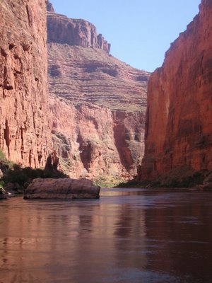
Marble Canyon, The Colorado River, September 2005 Posted by Picasa

Shan Creek near Grants Pass, OR in flood state. I didn't actually realize I was shooting a video.

Cattle Egret. Kern National Wildlife Refuge, CA. Posted by Picasa

Wednesday, August 2, 2006


God Beams, Palm Desert in California.

On the Ipod: Jesse Colin Young, Ridgetop

The Broken Car

So I have a broken car. Everything is fine with the car except the window doesn't quite work right. So it has spent a night in the shop.

Date: 1 August 2006
Miles Riding: 23.43
Weather: 100°F.
Average: 13.0
Bike: Commuter
Ipod: Fleetwood Mac, Homeward Bound
August Bike Mileage: 23.43

Date: 2 August 2006
Miles Riding: 10.00
Weather: 89°F.
Average 14.7
Bike: Road
Ipod: The Ronettes, Be My Baby
August Bike Mileage: 33.42

Monday, July 31, 2006

Open Up Your Pearly Gates


It's official. For those of you that haven't figured it out yet, I am leaving this desert wonderland for San Francisco in about two weeks. I can't quite imagine my life without the wilderness out the front door. But today, I left one of the largest employers in the world for one of the smallest. I've accepted a good position with a startup in San Francisco. It is with a certain sadness that I leave Mesa. I have been here a short two years, yet there is a long list of friends and acquaintances with which I must say goodbye. There are some folks I will miss, the new Jane, grocery store girlfriend, the ever happy hiking buddy, that guy Dan, coffee shop girlfriend, and the Meca Men. There are some I wish would join me. There's a bunch of other folks on this list. It's sad to leave these people behind.

But, then again. It's easy to get excited about San Francisco. I'll be working South of Market -- so I can get a place in the Mission or South of Market -- and ride to work. The food is really good. And there's art and the arts. And then there's the weather. And all the other people with bikes. I'll be able to wear my hair in dreadlocks or wear purple tights under my cutoff jeans, or just something simple like wearing shorts to work. There will be Jazz and open air cafes, and did I mention that the food is good? I could go on.

Ahead -- Options to exercise and hard work to do, all amidst the joyous clamour of a real city. And within miles of my family. Could I live in North Beach, Chinatown, Russian Hill, Japantown? Is there a French quarter? Je voudrais une tasse de cafe, si'l vous plait? Merci!


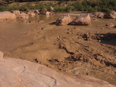
I know you will recognize this chocolate slurry as the Mouth of the Little Colorado River near the confluence with the Big C. We are hearing a lot of reports that it might floodPosted by Picasa

Oh Baby!

Oh! The outrage. Doesn't make much sense to me. Thanks to the Bike Riding Donut Guy for the link to that.

Sunday, July 30, 2006

CM San Francisco

http://www.flickr.com/photos/reinvented/39309101/in/photostream/
Photo by reinvented, shamelessly stolen.

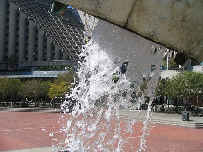
Critical Mass, last Friday of the Month, 6:00 PM, Justin Herman Plaza, San Francisco, CA, be there. Coined the "Dog Turd Fountain" by Herb Caen the Vaillancourt Fountain is one of my all time favorite pieces of plop.

Here are some photos from last week at sfPartyParty.


And then there's the lego version of the fountain. Don't miss the lego photographer risking his life at the top center.

bikescape

bikescape

First Water TH to Hackberry Springs


There are several routes to Hackberry Springs, several of my favorites are on this map. I find this best done as a loop hIke and can range from three to six miles depending on the route. I prefer the Garden Valley trail to a point just past the start of the Black Mesa trail, where the trail to Hackberry Springs heads off to the left. Today, however, we went up the easterly fork of the First Water creek, and returned by the route over the saddle between Hackberry Spring and Hackberry Mesa for a total of something less than 4 miles.


First Water Creek. Biggest part of today's effort was crossing the creek. Which we did about 25 times. I have never seen running water in this.


Near Hackberry Spring. We would have had to get wet to get to the actual spring.


Again near the Spring.


These pictures don't do the beauty of First Water Canyon any justice. The color of the lichen or moss on the rock today was a rich green.


This is the view from the saddle toward Four Peaks.


I think the rain encourages the Cholla pads to jump off the plant! Look how far that one jumped.


The Praying Hands are on the right.


© 2006 The Happy Hiking Buddy.

Although it didn't really rain on us during this hike it was drizzly at the outset and very humid throughout. Mosquitoes and no see-ums were alive and in a biting mood. I was literally drenched with sweat at the end of this hike because of the humidity.

Although I didn't think to take a picture of Weaver's Needle, there is a good view of it near the end of this loop.

Friday, July 28, 2006

The Wind Without a Name


Red Wall Cavern


Ocotillo


Is that Mt McDowell?


Organ Pipe Cactus National Monument

Today's a day of impending change; change of place, change of time, change of promise, change of venue. A change is in the wind.

On August 31 I will end my contract here in Mesa. I will leave the home of the dark helicopters and return to my aboriginal homeland. It is a bittersweet melancholy, the taste of the desert in my mouth, the windblown dust of an Haboob riding on the toe nails of a monsoon, potentially a thunderstorm, the smell of ozone in the air. The knowledge that Sunday's hike to Hackberry Springs may be the last time I get to walk through that steep canyon made up of the tuf layer with it's lichen orange and green-- a castled epiphany to the desert's glory. Me, literally walking in a huge river bed, an absolutely dry river bed in a lush green desert, surrounded by this glory. Arizona has grown to become part of me -- it has become part of who I am. I am going to miss it here. Jill sums it up really well.

Although the wind has a name in Southern California -- the famous Santa Ana wind -- the wind in Northern California remains nameless. It has no name. Perhaps that nameless wind will blow me back this way again. Perhaps it is just called fog.

Date: 28 July 2006
Miles Riding: 10.69
Weather: 92°F.
Bike: Road
Ipod: Indigo Girls, Walk Away
July Bike Mileage: 95.16

Thursday, July 27, 2006

Desert Rat Tortoise.


Photo © 2006 The Happy Hiking Buddy.

So today -- we hiked the Wind Cave Trail in the Usery Mountains. It's a nice little climb; 6 or 700 ft verticle over about a mile and a half. We saw the fountain blasting away in Fountain hills some 30 or fourty miles away.

We reminisced about our first hike together, either one or two years ago on the second of July. Starting at 6 AM we hiked the Bluff Springs Loop in the Superstition Wilderness. By the time we finished the 11 mile loop, it was 109 degrees and 11:30. That first hike was almost the hardest hike we have done together.

The picture above was taken at the car, where a critical decision was made to leave the camera in the car. I regretted this later when I found a Desert Tortoise on the trail. It was a young one. About one quarter the size of this one I saw at Joshua Tree several years ago.


We talked about how we better go do that hike again.

Mileage Walking: 3.2
Weather: 93°F. cool!!

Tuesday, July 25, 2006

Welcome Back to AZ -- Did You Miss Me?

The first time I visited Arizona I was with my young daugther. She insisted Arizona was a woman we were going to visit -- "Are we going to meet Arizona?" She would say. I tried my hardest to explain that Arizona was a place, but her 3 or 4 year old mind just wasn't cooperating.
Welcome to Arizona. It isn't what you think it is -- it's a woman you can meet.


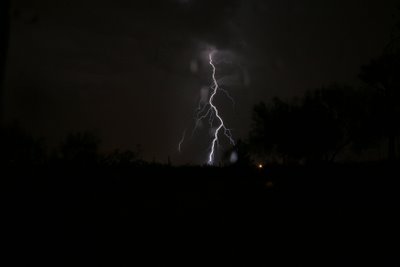
It's storming. Lightning strikes are so frequent that it's like daylight. The crashes are close enough now so that I am afraid to stand outside. I can hear the crack as the lightning strikes. From where I am there is lightning in every quadrant of the sky.

Date: 25 July 2006
Miles Riding: 14.08
Weather: 109°F.
Bike: Road
July Bike Mileage: 84.47

Presently, it has finally started to rain. And rain it is. It's as if the heat creates a surface tension on the floor of the desert that the water can not penetrate. Once the tension is broken a torrent emerges.


It's just a few minutes later and it's now raining at the desert's normal 3-5 inches an hour rate -- and we are probably about to flash flood. There's several inches deep of water right near my patio and around the drive. There's no indication I need to move the valuables uphill yet.


It has slowed to a light rain now, and the light show rages on.

Sunday, July 23, 2006

Hyatt SFO

Miles today == 8

Despite a grand plan to travel about 800 miles today by car, train, bus and cab, from San Francisco to Phoenix Arizona via Lost Wages, I am sitting in a bar in the Hyatt Regency SFO (compliments of US Airways) and listening to the Marshall Tucker Band, having just devoured a Club Sandwich.

It's been spectacularly hot here -- and I believe it was 108 yesterday in San Mateo -- which is incredibly hot. I believe the fog has rolled in finally -- because the ground looks damp and the AC started working. It's a heck of a lot nicer in Phoenix.

I suspect this hasn't been my best travel trip. I did read most of the Memoirs of a Geisha while waiting for the plane that never came.

If all goes well I should catch a plane from SFO to Phoenix in the morning and be seriously late for work. I guess we'll just try again tomorrow.

Wednesday, July 19, 2006

Into the Wind.

I took a spin down to fetch dinner and see if there might be a repeat of yesterday's dust storm. Leaving my house and heading West and North, I headed into a brisk headwind. I had spaghettti and meatballs and headed for home into a brisk headwind. There was a headwind for the entire ride. Except for during the two flat tires I got. That's four in as many days. I haven't had that many flats in as many months. Fortunately, Today, I had tire "irons" and a Zefal HPSomething (Thanks Jeanne). So all was well. Since I only had one spare -- I was pretty glad that I flatted out right in front of Paragon Cycling.

Date: 19 July 2006
Miles Riding: 18.96
Weather: 108°F. 14% Humidity.
Bike: Commutadora
July Bike Mileage: 70.39

Cameras 1 -- Dust storms 0. I carried the camera, I didn't see a thing.

Tomorrow I leave for Frisco (Did I say that? gag, er, sic), I mean San Francisco, for a few days. I was considering taking my bike and wearing tights to my interview just to make sure we get off to a good start. First impressions are very important. I decided instead to rent a car and get cleaned up a bit (you know -- suitcoat, blue jeans and a tie). I will be a bike free gas guzzling city dweller for a day or two.

I can already smell the ocean. Feel the wet sand between my toes, smell the coffee wafting through the open cafes, hear the cable cars, my seafood searching antenna extending ... is that chow fun I see ahead? Fish cheeks and tapas ... and later wasabi and oysters.

What to do Saturday?

Monday, July 17, 2006

About Wilderness


I just want to make sure that no one starts thinking that the Superstitions are a great place to mountain bike. The Superstitions (Superstition Mountains) -- commonly called just "The Sups" -- are designated wilderness under the 1964 Wilderness Act -- meaning , 1. Most vehicles are not allowed. It's quite severe, steep and extreme, 30 lbs of food and water would be a better choice to carry than 30 lbs of bike. It's a great place for the uninitiated to get lost and die, or seriously hurt, but it's not the best choice to ride. I seriously suspect that the most commonly used vehicle in the Sups is the helicopter, but it might be the gurney with the wheel. Elevations vary from 1500 to 4500+ feet and weather and potential for illness due to exposure are signifigant every day. There are fairly permanent sources of water at Charleybois and Second Water -- and Hackberry Springs, but I would never rely on them. I have a lot of wildeness experience, and every time I go in to the Sups, I come out in pain. I've been disoriented, run out of water, become overheated, and survived. Be careful, carry a map and compass, water, and file a trip plan with a trusted friend. It's really verticle.

If you want to know more about what a wildernes designation means -- try this.

Personally -- I believe that the designated wilderness areas should be vehicle free -- however -- I am a lot more benevolent toward snowmobiles than any other form of wilderness transport, except snowshoes or skis. This is primarily because the footprint is going to melt -- so damage is very minimal. In the same vein I am tolerant of ATVs in sand dunes -- because the footprint is (for the most part) transitory. I am particulary unfond of the noise these vehcles make, and the permanent damage that ATV's do in other parts of the desert.
There are large tracts of opportunity for vehicular travel in the National Forests, National Parks and other less than wilderness areas.

Hwy 60 rolls through the superstitions to Globe. It's a beautiful winding drive through a tight dramatic canyon littered with roadside crosses. It looks dangerous to me -- but might make for a nice road trip on a bike or in a 57 T-bird.